May2021 Update
The story of how GBGLF volunteers became involved in and developed expertise in wetland evaluation and water levels.
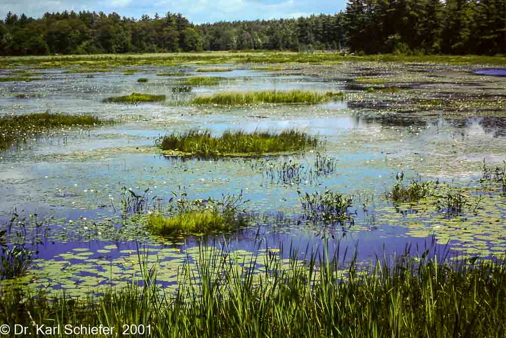
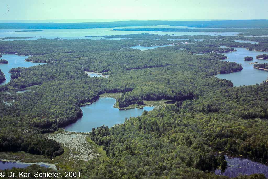
Back in the summer of 2001, the late well-respected aquatic biologist Dr. Karl Schiefer called me and said regarding the low water levels – “Most people are concerned about dinged propellers, but in fact the most significant impact is what has happened to our wetlands.” With that, Karl invited me to come and take a look at the large Longuissa Bay wetlands. The next day, I picked up Karl from his cottage in Cognashene and we boated over to Longuissa Bay to show me water lilies and pickerel weeds trying to grow in dried-up sediments. He described what normally was perfect spawning and nursery habitat for fish like bass, pike and musky, warning that if these fish cannot find suitable habitat, they simply will not spawn. That in turn, he said, will impact the recreational fishery for years to come, depending on how long the water remains so low (try 14 years – 1999-2012). Then Karl suggested that we get some ariel photos to document the extent of this loss of wetland habitat.
Initially we found a pilot who had a camera that could be mounted underneath the plane’s fuselage (this was before common usage of digital cameras). These photos showed significant loss of wetland habitat for five wetlands. But our question immediately was: What is the full extent of loss, and is any government agency even aware of this?
Then in 2003, McMaster University’s Prof. Pat Chow-Fraser called me (OMNRF suggested she call me) and said she would be interested in doing some wetland and fish assessment on the Bay. Pat and I chatted at a picnic table in Port Severn for two hours, and thus her excellent peer- reviewed and published research on the Bay began and has continued to this day.
Prof. Chow-Fraser looked at our air photos and said we really needed such documentation for the entire coast, but she knew that would be costly. So I connected with a professor at Nippissing University who had starting using satellite imagery for his research. He helped us figure out what type of imagery to acquire, and what software was needed to access and use it. (He came down to the Bay to see for himself if what looked like water lilies were actually water lilies – and stressed the importance of accurate ground- truthing.) Soon after, Prof. Chow-Fraser found a post-doctoral grad who had experience using high-resolution satellite imagery to assess habitat. The funding campaign for that work was led by John Seagram.
Karl also said that in order to understand what might be causing the extreme water levels required expertise in the complex world of hydraulic engineering. (I was dismayed.)
Around the same time, I was introduced to Bill Bialkowski – a hydraulic engineer who knew a lot about flows and levels from his extensive professional career. And Bill and his wife had just built a cottage on the Bay. I had been able to get the U.S. Army Corps of Engineers at their Detroit offices to collect depth measurements of the St. Clair River near the Bluewater Bridge. They also found much earlier depth data and sent it all to me. I could see the difference in depth measurements but could not tell what that meant, if anything, to low water levels on Lake Michigan/Huron and Georgian Bay. Bill went to work, though, and was able to tell us that it appeared the St. Clair River conveyance had increased, and that increase could be a contributing factor to the low water levels we were experiencing. That theory inspired us to work to see if there were experts out there who could help assess this issue.
To our surprise and delight, one of the three North American coastal consulting firms was based right in Ontario at Oakville, and the principal officer and researcher that Bill and I first met with was Rob Nairn, who had a cottage on the Bay. With us we had Bill’s initial work and an extensive time series of air photos of the St. Clair River at the Bluewater Bridge. (Once again Karl Schiefer had recommended these photos). (The former E.D. of GBA, John Birnbaum, and I had purchased these from the National Air Photo Library in Ottawa while we were there for Recreational Boating meetings.) One of Rob Nairn’s staff looked at the photos and said he thought there was enough change in the St. Clair River that it could be impacting the outflow. To make a long story short, we helped raise the $250,000 for Baird Report I, which woke up governments at all levels on both sides of the border. Once again, John Seagram, this time with Roy Schatz, led the campaign to raise those funds.
Most importantly, from Prof. Chow-Fraser we now had the environmental impact of the sustained low water levels – a very significant 24% wetland habitat loss. To put that in context, you need to know that the International Joint Commission must now consider any environmental impacts of their decisions on water-level regulations. Their obligation regarding discharges from Lake Superior to Lakes Michigan/Huron and Georgian Bay is to “balance upstream and downstream interests”. Wetland biologists know that wetlands benefit from a fluctuation range in water levels of about 5 to 5.5 feet. But unlike any other Great Lake, we are now experiencing a range of almost 7 feet. At both low and high extreme levels, we now have clear evidence of ecological and economic harm. If the extremes were all natural, we might have reason to pause, but they are clearly not all natural. Changes to the St Clair River’s conveyance capacity have yet to be determined, even though the IJC in 2013 recommended this work. In addition, the excess discharges of water from Lake Superior during high levels and the withholding of such discharges during low levels – all to keep Lake Superior within a tight water-level range of 4 feet – is just unacceptable. Where is the “balance of interests” in those IJC decisions?
Where are we now then? We want to purchase high-resolution 2019 satellite imagery of the east coast of Georgian Bay in order that Prof. Pat Chow-Fraser can determine the amount of wetland habitat loss during the recent extremely high water levels. Will you contribute to the $20,000.00 cost so we can use that evidence in meetings with the IJC and with government agencies at all levels?
No other organization is doing this type of detailed analysis on the ground and in university labs. You can help make that happen.
Thank You, Mary Muter, Chair
MAKE YOUR IMPACT TODAY
Donations help us make a difference
because we can continue our work
and bring it to a conclusion for future generations.
We depend on private donors, foundations and sponsors like you.
Charitable donations can help reduce, or even cancel out, the tax
you would otherwise have to pay to the government.
PREFER TO DONATE BY MAIL? HERE'S HOW...
Please make out your cheque to Huronia Community Foundation
and mark in the notation line "for Georgian Bay Great Lakes Foundation" and mail it to:
Huronia Community Foundation, P.O. Box 324, Midland, Ontario, L4R 4L1
SHARE DONATIONS ARE NOW EASIER
Donate Securities to the Georgian Bay Great Lakes Foundation Fund
through the Huronia Community Foundation
To ensure that we credit the right fund, ask that donations be directed to:
Georgian Bay Great Lakes Foundation Fund
Georgian Bay Great Lakes Foundation is an Ontario registered not-for-profit
affiliated with the federally-registered charity, Huronia Community Foundation
You can get more information about claiming donations from the CRA website and your Financial Advisor.


